|
 W³TROPICOS
QUICK SEARCH
MO PROJECTS:
Africa
Asia/Pacific
Mesoamerica
North America
South America
General Taxonomy
Photo Essays
Training in Latin
America
MO RESEARCH:
Wm. L. Brown Center
Bryology
GIS
Graduate Studies
Research Experiences
for Undergraduates
Imaging Lab
Library
MBG Press
Publications
Climate Change
Catalog Fossil Plants
MO DATABASES:
W³MOST
Image Index
Rare Books
Angiosperm
Phylogeny
Res Botanica
All Databases
INFORMATION:
What's New?
People at MO
Visitor's Guide
Herbarium
Jobs & Fellowships
Symposium
Research Links
Site Map
Search
|
 |
Study area: Cajas National Park
|
Home
|
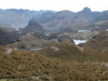
Panoramic view
|
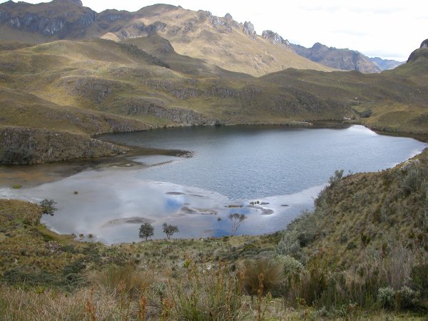
 Lake Totoras
|
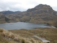 Toreadora Lake
|
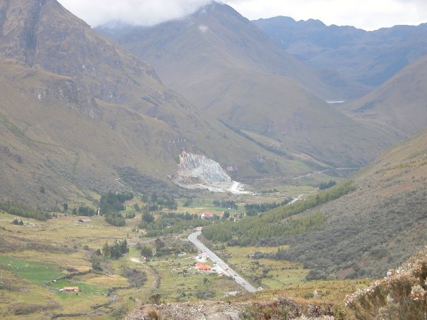
 Park and police Control at Cuenca-Molleturo
|
Cajas National Park (CNP) belongs to Ecuador's National System of
Protected Areas and gained it status in 1996. Since December 2002,
the Park's administration is managed by a consortium formed by ETAPA
(County office of Telecommunications, Water supply, Sewer system,
and Environmental issues), the Municipality of the city of Cuenca,
and local communities. The Park comprises 28,544 hectares and the
páramo ecosytem occupies around 90% of the area. The climate
is cold and humid; there is however, considerable variation in the
weather that can change rapidly from calm to strong winds, from
cloudy to intense sun, from dry to fog or drizzle, and from hard
rain, to hail and even to snow. The minimum daily temperature is
-2°C and the maximum is 18°C. The annual mean precipitation
is 1200 mm. In CNP there are no volcanoes and the páramo lies
between 3000 and 4450 m. Pleistocene glaciers carved the landscape
and formed more than 235 lakes and lagoons. Two rivers drain the
eastern slopes towards the city of Cuenca. Cuenca is a city of some
300.000 inhabitants and was added to the UNESCO world heritage sites
in 1999 as an outstanding example of a planned inland Spanish colonial
city. Thousands of Ecuadorian and international tourists visit the
city and take advantage of the proximity of the Park to explore this
natural area. A new highway that connects Cuenca with the Coastal
region crosses the northern part of the Park. In this area is located
the new information and interpretation center by Lake Toreadora. Gas
and other hazardous materials cannot be transported on this highway.
Park rangers and police officers control the traffic through this area. The other
access road, Soldados-Angas, is in the southern part; this is an
unpaved road, less frequented by tourists except trout fishermen.
Some 15.000 tourists visit the area each year. CNP was registered in
January 2003 in the Ramsar convention on wetlands. The new management
has been quite successful, and they have over the last few years
invested towards infrastructure and personnel. They have managed to
eliminate plantations of Monterrey pine within the park borders and
have controlled the access of cattle in most areas. However, there
are still some difficulties in the bordering areas with private ranches
and cattle can still be seen from time to time. A new social project
directed toward a dialog, understanding and support of the surrounding
communities is underway.
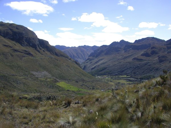
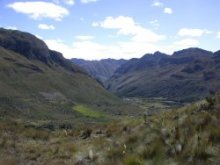 U-shaped valley
|
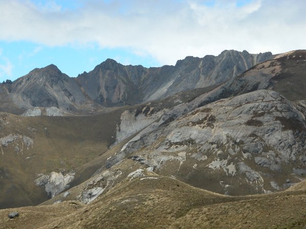
 Tres Cruces
|
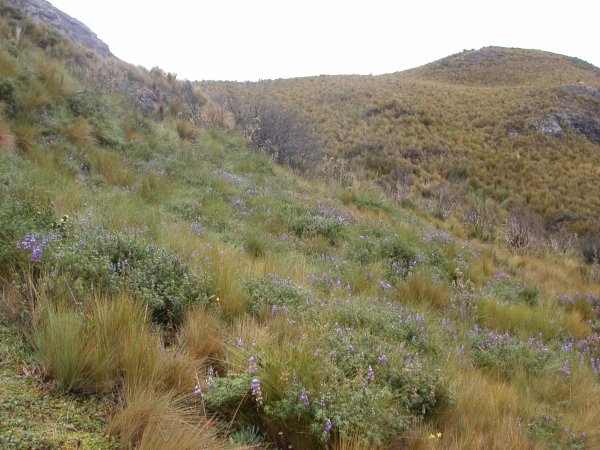
 Grass páramo
|
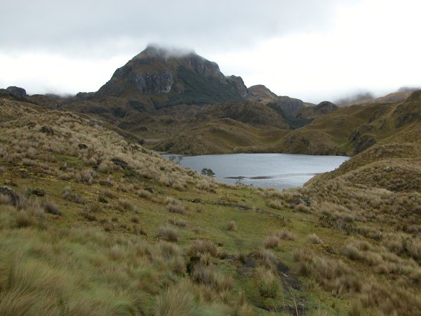
 Lake Patoquinoas
|
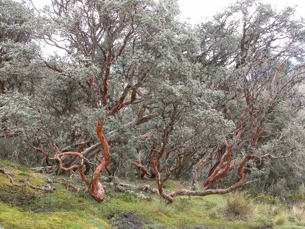
 Polylepis forest
|
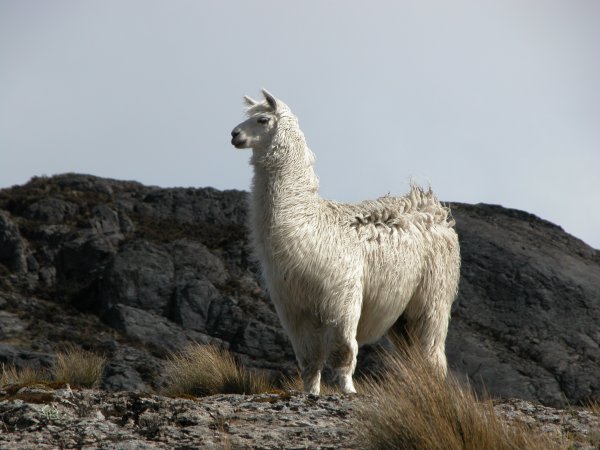
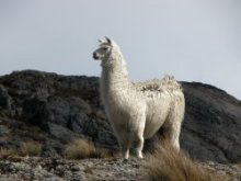 Llama
Llama
|
|
|
|