QUICK SEARCH
MO PROJECTS:
Africa
Asia/Pacific
Mesoamerica
North America
South America
General Taxonomy
Photo Essays
Training in Latin
America
MO RESEARCH:
Wm. L. Brown Center
Bryology
GIS
Graduate Studies
Research Experiences
for Undergraduates
Imaging Lab
Library
MBG Press
Publications
Climate Change
Catalog Fossil Plants
MO DATABASES:
W³MOST
Image Index
Rare Books
Angiosperm
Phylogeny
Res Botanica
All Databases
INFORMATION:
What's New?
People at MO
Visitor's Guide
Herbarium
Jobs & Fellowships
Symposium
Research Links
Site Map
Search
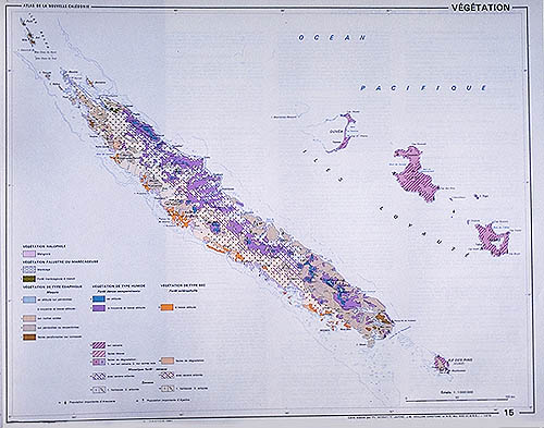
Diversity, Endemism, and Extinction in the Flora and Vegetation of New CaledoniaVegetationA wide range of vegetation types are present on New Caledonia, reflecting the various climatic and edaphic conditions found on the island.
Morat et al. (1981), expanding on previous studies (Aubréville, 1965; Balansa, 1872; Guillaumin, 1921; Schlechter, 1905; Virot, 1956), described and mapped broad categories of vegetation based primarily on physiognomy (see also Lowry et al., 1997, for additional comments on vegetation classification). They recognized the following types:
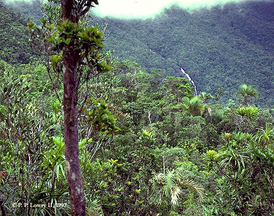
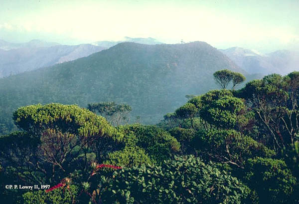
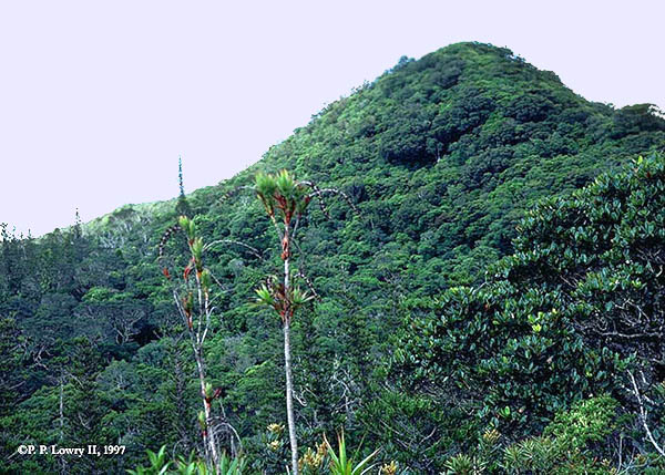
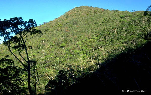
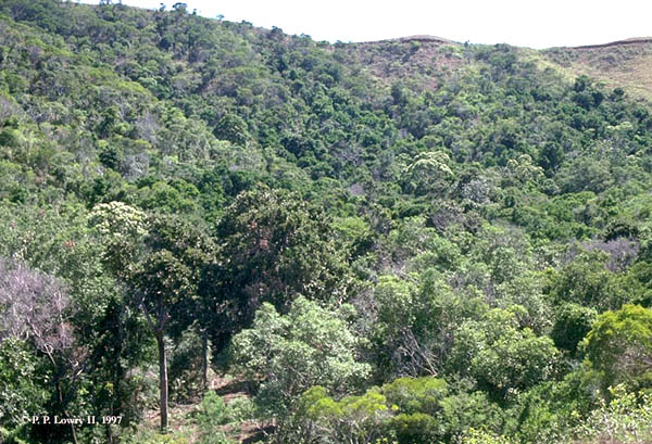
Examples of moist evergreen forest in New Caledonia. Top row, left to right: Eastern slope of Mt. Panié (ca. 1200m); summit of Mt. Humboldt (1618m). Bottom row, left to right: Summit of Mt. Mou (1219m); southern slope of Kopéto massif (800m). 1. Moist evergreen forest. Three types are recognized: Moist evergreen forests have a closed canopy of moderately sized trees (up to 20 m at lower elevations; about 3-8 m at higher altitudes), and cover ca. 22% of the territory, including about 3,000 km² on Grande Terre, mostly in the east and mountainous center of the island, and an additional approximately 1,000 km² on limestone primarily in the Loyalty Islands and on a portion of the Ile des Pins.
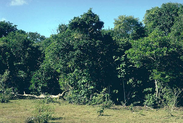
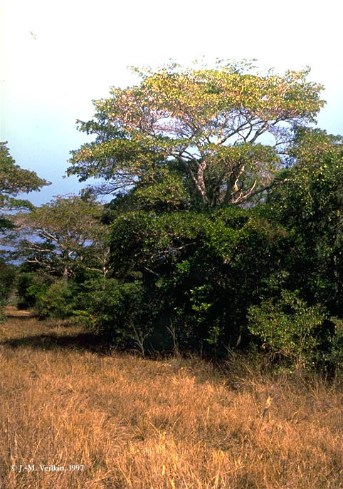
Examples of sclerophyllous forest in western New Caledonia. Left to right: Remnant forest at Népoui, west of Poya; edge of forest at Beaupré, south of Poya; partially disturbed stand on private land, southeast of Pouembout. 2. Sclerophyllous forests. This formation with its dense, closed canopy occurs mostly on Grande Terre on sedimentary substrates (chert, sandstone, limestone, etc.) between 0-300 m, and is dominated by semi-deciduous trees ca. 10-12 m in height (Jaffré et al., 1993). Sclerophyllous forests were once widespread in the drier west of Grande Terre, but intact stands are now extremely restricted, covering only about 100 km², just over 2.2% of their estimated original area of about 4,500 km²; an additional ca. 250 km² of degraded and secondarized sclerophyllous forests also remaining (Jaffré et al., 1993; Bouchet et al., 1995).
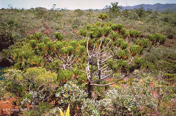
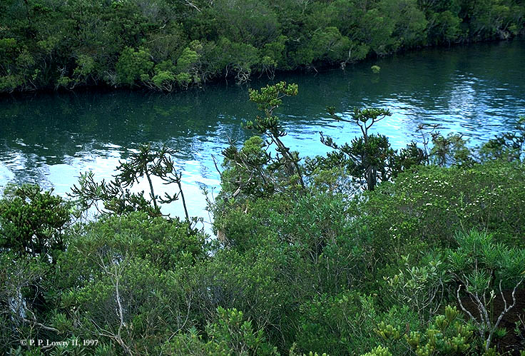
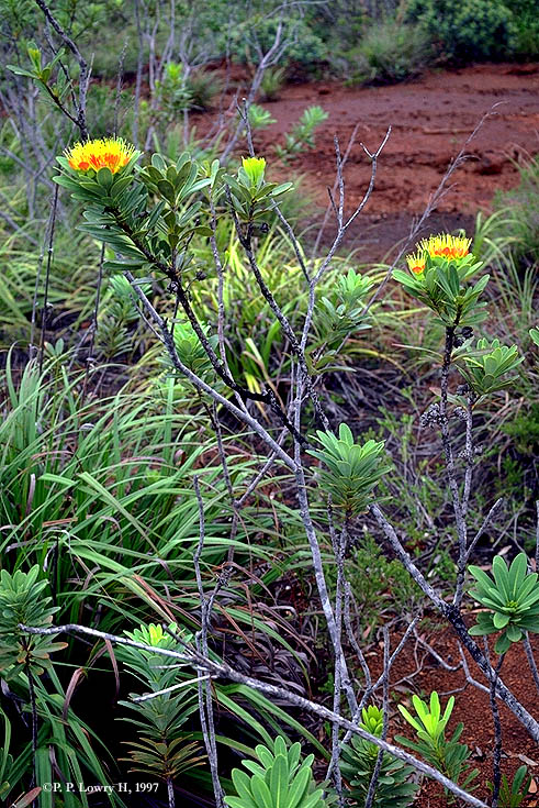
Examples of maquis vegetation on New Caledoina. On the Plaine des Lacs in the far south (two photos on left); Xanthostemon aurantiacum (Myrtaceae) in the Rivière Bleue Reserve. 3. Maquis vegetation. This is a characteristic low, sclerophyllous, evergreen, heath-like formation, largely restricted to ultrabasic substrates at various altitudes on Grande Terre. Today it covers around 30% (4,500 km²) of the territory, including some small areas that occur on acidic substrates). 4. Other vegetation types. Mangroves are found in areas with saline water subject to tidal influence; their floristic composition differs between the east and west coasts (Veillon, 1993). Swamp vegetation occurs in localities with periodic standing water, including some in areas with ultrabasics (e.g., the Plaine des Lacs in the south). 5. Secondary vegetation. Anthropogenic formations resulting from direct or indirect human action now cover a little over 50% of New Caledonia, comprising various degraded forms of the natural vegetation types (Morat et al., 1981).
|
© 1995-2025 Missouri Botanical Garden, All Rights Reserved
4344 Shaw Blvd.
St. Louis, MO 63110
(314) 577-5100
Technical Support