QUICK SEARCH
MO PROJECTS:
Africa
Asia/Pacific
Mesoamerica
North America
South America
General Taxonomy
Photo Essays
Training in Latin
America
MO RESEARCH:
Wm. L. Brown Center
Bryology
GIS
Graduate Studies
Research Experiences
for Undergraduates
Imaging Lab
Library
MBG Press
Publications
Climate Change
Catalog Fossil Plants
MO DATABASES:
W³MOST
Image Index
Rare Books
Angiosperm
Phylogeny
Res Botanica
All Databases
INFORMATION:
What's New?
People at MO
Visitor's Guide
Herbarium
Jobs & Fellowships
Symposium
Research Links
Site Map
Search
Vietnam Botanical Conservation ProgramViet Nam Home | Introduction | Study Sites & Images | Viet Nam LinksSTUDY SITES - Northern Vietnam - CAO BANG Click on the image to see a larger image.
Total Area: 663,798 ha.
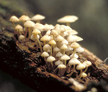
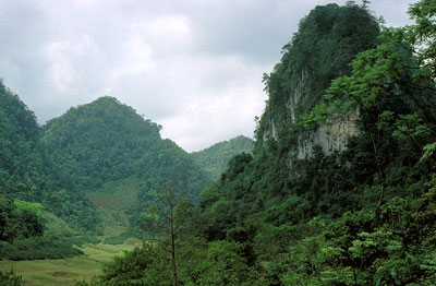
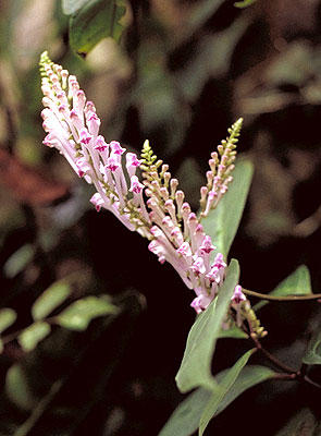
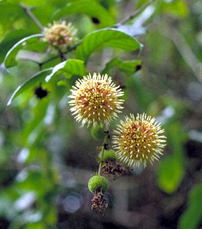
ETHINIC DIVERSITY Nine major ethnic groups are located here including the Tay, Nung, Dao, and H'mong. PHYSICAL The landscape of Cao Bang is unique. Massive limestone deposits, dating from the Paleozoic age and reaching a depth of over 1000m, occupy a large portion of the province. Powerful geological uplifts during the Mezozoic raised these limestone ridges to considerable heights, where erosion produced dramatic massif and rocky outcrops, particularly along the southern margin. Further erosion produced highly dissected and isolated mountain ridges and column-like mesae. Average elevation is 600-1000m, but reach nearly 1400-1500m in the extreme northwest portion of the province. Lower valley areas are found between 300 to 1000m. The largest mountain areas in Cao Bang are of granitic and related substrates and occur mainly in the western part of the province. These rise to elevations of 1978 m. SEASONS Cao Bang experiences four distinct seasons. Summers are hot (25°-30° C) with abundant rainfall (150-300 mm). Winters are dry and rather cool (near 15° C at 200-300m). BIOLOGICAL Plant and animal diversity is extraordinarily high for two reasons: Cao Bang's position between two floristic kingdoms, the Holartic and Palaeotropic, and diverse natural conditions. The biological richness of the province has scarcely been recognized since few botanical expeditions have focused on this region. Recent investigations have resulted in new species discoveries and descriptions of its rich forest communities which are unique to Viet Nam. Cao Bang and other northern provincial locations may harbor the highest botanical diversity in all of Viet Nam and possibly Indochina. Within the Northern Indochina Subtropical Forests of Cao Bang, mixed forests of evergreen and coniferous tree species occur. Three protected areas are designated in this province, Trung Khanh, Nature Reserve, Nui Pia Oac Nature Reserve and one cultural and historic site, Pac Bo, covering a total of only 21,908 ha, (less than 18%) of the total natural forest area of 122,486 ha. Due to extensive logging and land conversion, only 18% of the total land area is covered in natural forest. The Black Gibbon (Hylobates concolor) has been recorded from within Cao Bang but the status and distribution of this species is poorly known. THREATS: The potential for hydroelectric development within Cao Bang could have severe effects on the biodiversity of this rich region.
|
© 1995-2025 Missouri Botanical Garden, All Rights Reserved
4344 Shaw Blvd.
St. Louis, MO 63110
(314) 577-5100
Technical Support