QUICK SEARCH
MO PROJECTS:
Africa
Asia/Pacific
Mesoamerica
North America
South America
General Taxonomy
Photo Essays
Training in Latin
America
MO RESEARCH:
Wm. L. Brown Center
Bryology
GIS
Graduate Studies
Research Experiences
for Undergraduates
Imaging Lab
Library
MBG Press
Publications
Climate Change
Catalog Fossil Plants
MO DATABASES:
W³MOST
Image Index
Rare Books
Angiosperm
Phylogeny
Res Botanica
All Databases
INFORMATION:
What's New?
People at MO
Visitor's Guide
Herbarium
Jobs & Fellowships
Symposium
Research Links
Site Map
Search
Diversity, Endemism, and Extinction in the Flora and Vegetation of New CaledoniaClimate and TopographyNew Caledonia's climate is similar to that of other tropical islands situated at comparable latitudes and with substantial geographic relief. During the warm season (mid-November to mid-April), frequent tropical depressions and cyclones produce large amounts of precipitation. After a brief transition, the cool season (mid-May to mid-September) begins, during which rainfall is lower, resulting from cold fronts associated with polar low pressure areas. This is followed by another transition period (mid-September to mid-November) with generally clear weather and increasing southeasterly trade winds (Service Métérologique de la Nouvelle-Calédonie et Dépendances, 1981).
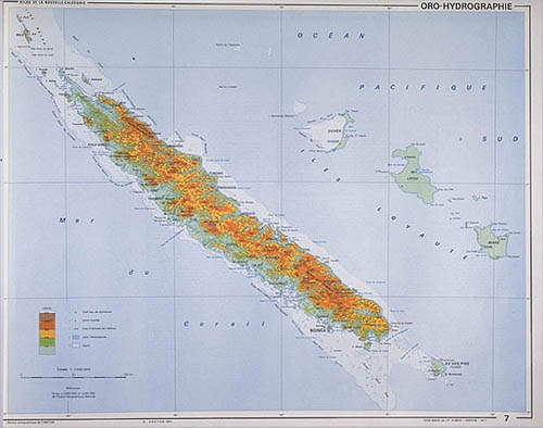
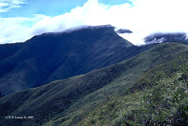
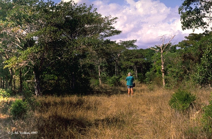
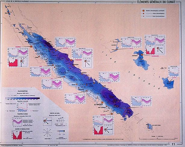
Top row, left to right: Topography of New Caledonia (source: Atlas de la Nouvelle-Calédonie. ORSTOM, Paris); high elevation moist evergreen forest and maquis on the Mt. Humboldt massif (1618m). Bottom row, left to right: Sclerophyllous forest at low elevation near Beaupré, south of Poya (photo: J.-M. Veillon); rainfall and climate on New Caledonia (source: Atlas de la Nouvelle-Calédonie. ORSTOM, Paris). The topography of Grande Terre is dominated by a chain of high mountains that runs along its entire length, with many massifs above 1,000 m, and five summits that exceed 1,500 m. These mountains strongly influence precipitation patterns, generating high levels of orographic rainfall when the dominant winds from the ENE to SE sector are uplifted as they encounter the island's relief. Precipitation is highest along the windward, eastern slope, where annual totals range from nearly 2,500 mm to over 4,000 mm in some areas. The leeward western side of the island lies in a rain shadow formed by the central chain, and annual precipitation is generally below 1,500 mm, reaching only 800 mm at Ouaco (Section d'Hydrologie de l'ORSTOM and Service Territorial de la Métérologie, 1981; Danloux, 1993). In the driest years rainfall can be as low as 250-300 mm at some sites (Danloux, 1987). The conditions on New Caledonia are thus similar to those found on many other tropical islands. However, New Caledonia's geological and phytogeographic history, coupled with its large areas of highly selective ultrabasic soils, present unique dimensions that have resulted in the evolution of an impressively diverse flora and exceptionally high levels of endemism.
|
© 1995-2025 Missouri Botanical Garden, All Rights Reserved
4344 Shaw Blvd.
St. Louis, MO 63110
(314) 577-5100
Technical Support