QUICK SEARCH
MO PROJECTS:
Africa
Asia/Pacific
Mesoamerica
North America
South America
General Taxonomy
Photo Essays
Training in Latin
America
MO RESEARCH:
Wm. L. Brown Center
Bryology
GIS
Graduate Studies
Research Experiences
for Undergraduates
Imaging Lab
Library
MBG Press
Publications
Climate Change
Catalog Fossil Plants
MO DATABASES:
W³MOST
Image Index
Rare Books
Angiosperm
Phylogeny
Res Botanica
All Databases
INFORMATION:
What's New?
People at MO
Visitor's Guide
Herbarium
Jobs & Fellowships
Symposium
Research Links
Site Map
Search
One-hectare Tree Inventory Plots
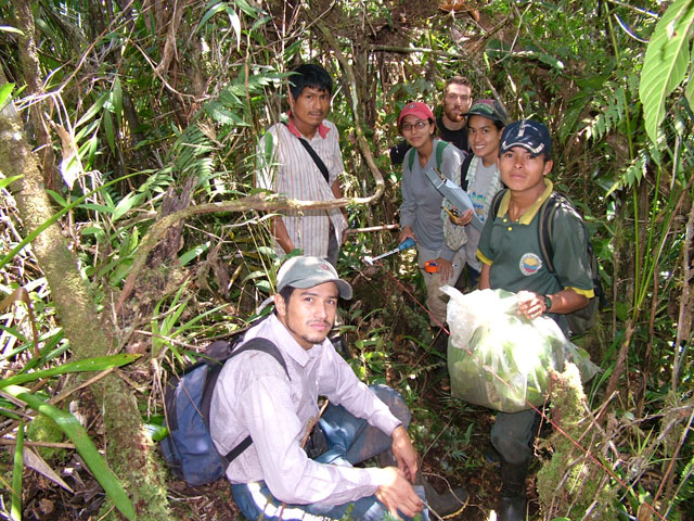
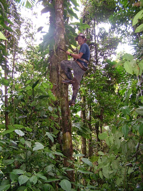
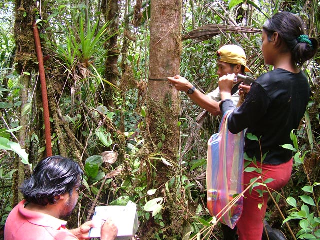
The original proposal for this project submitted to and approved by NSF included the establishment of six one-hectare permanent forest inventory plots in the Cordillera del Condor, including all trees and lianas ≥ 10 cm DBH and applying the standard methodology for such plots (Phillips et al., 200). The plots were to be established in pairs, with one forest plot on sandstone substrate at each of three sites in the northern, central and southern portions of the Cordillera del Cóndor in Ecuador, and a second plot at each site on non-sandstone substrate, as close as feasible to the “sandstone” plot. The fieldwork for the one-hectare forest inventory plots was carried out by the students and instructors on each of the dendrology courses in the Cordilera del Cóndor that were an integral part of this project. The plan called for the participants in each of the three dendrology courses to establish two one-hectare tree plots on nearby areas of contrasting sandstone and non-sandstone substrates. The first pair of plots was established according this plan, during the first dendrology course in the northern portion of the Cordillera del Cóndor, on land belonging to the Shuar communities of Kuankus and Yunkumas. The layout of the remaining four tree plots, however, deviated from the original plan. Tree plots 3, 4 and 5 are arranged along an altitudinal transect of the sloping sandstone plateau at Las Orquídeas, west of the Río Nangaritza in the southern portion of the Cordillera del Cóndor plot. The sixth plot is located, by itself, on a ridge below the sandstone plateau in the Río Quimi watershed, in the central portion of the Cordillera del Cóndor.
This plot is located on non-sandstone substrate with clay soil, on land belonging to the Shuar community of Kuankus. In floristic composition and structure, the forest at this site is very similar to a typical terra firme forest type that occurs in large areas of Amazonian Ecuador.
This plot is located just 2.5 km distant and 500 m higher in elevation than the Yunkumas plot, but on top of the sandstone plateau known to the Shuar in this region as Cerro Yuank Naint, the “Mountain of the Vultures”. The forest composition and structure are very distinct from the Kuankus plot, with some of the dominant species that are restricted to sandstone-derived soils, and much shorter in stature with much less biomass than the Kuankus plot.
This plot is located on a steep slope just above the west bank of the Río Nangaritza. It is situated below the sandstone plateau of the Hollin Formation, but because the sandstone has eroded down onto the slopes below, the soil has a high sand content and the forest has many tree species that are typically restricted to the sandstone formation.
This plot is located just one km west of and 200 m higher than Plot # 3, but it is located on a nearly level site atop the sandstone plateau in the area of Las Orquídeas. The forest canopy is very uneven and the basal area and biomass of the forest is much lower than in Plot # 3. Some tree species are shared between Plots 3 and 4, but most of the dominant species are different between the two plots.
This one-hectare tree plot is located about 4 km west of, and 500 m higher in elevation, than plot 4, near the upper edge of the sloping sandstone plateau west of the Río Nangaritza above the village of Las Orquídeas. Nearly all of the dominant tree species in the plot are different from those in Plots 3 and 4 on the same altitudinal transect.
This tree plot is located in the Río Quimi watershed in the central portion of the Cordillera del Cóndor. It is the only one among the six plots established in this project that is not laid out in a 100 m x 100 m square pattern; it is a rectangular plot, 250 m x 40 m and includes part of a ridge line, a steep slope and gully below the ridge. It is located several hundred meters below the sandstone plateau in this area, but the soil along the ridge has sand eroded from the plateau above, with tree species typical of the sandstone substrate. The gully bottom has species more typical of the terra firme forests in lowland Amazonian Ecuador.
|
© 1995-2025 Missouri Botanical Garden, All Rights Reserved
4344 Shaw Blvd.
St. Louis, MO 63110
(314) 577-5100
Technical Support