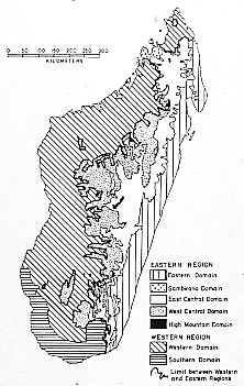
Among many other applications, a careful chorological study of the Malagasy flora would make it possible to test the validity of several widely accepted ideas regarding "phytogeographic" zones in Madagascar. For example, "low-" versus "mid"-elevation forests in the east have traditionally been delimited approximately along the 800 m coutour line. Perrier de la Bâthie (1921) was the first to suggest this on the basis of rather weak chorological criteria,
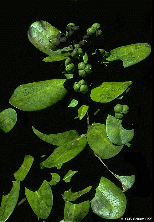 Anthostema madagascariensis
such as his contention that the genus Anthostema (Euphorbiaceae) and species of Myristicaceae extend up to 800 m, while other taxa such as Weinmannia (Cunoniaceae), and Tambourissa (Monimiaceae) supposedly reach their lower limits at this same elevation. But in reality, for example, Anthostema and species of Myristicaceae rarely if ever reach 800 m, and the same kind of variability occurs among the other so-called "indicator" taxa.
![]()
![]()
![]()
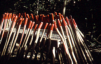
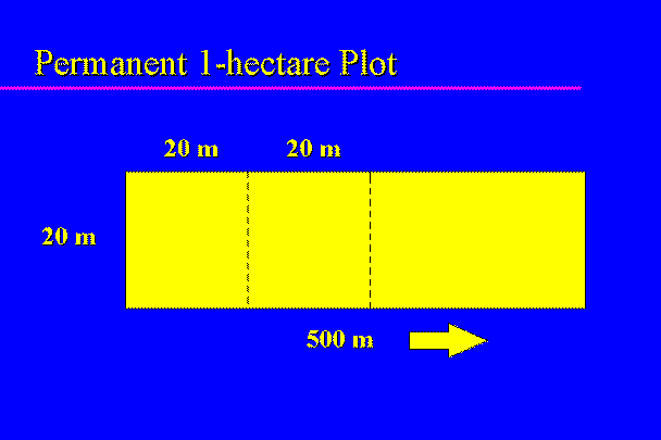
During the last several years the Missouri Botanical Garden, in collaboration with Malagasy students who have received training from our program, and our colleagues at the Department of Forestry and Fisheries Research (FOFIFA) and the Parc Botanique et Zoologique de Tsimbazaza, have together established about 20 permanent 1-hectare plots throughout the wet forests of Madagascar (Schatz and Malcomber, in press; unpubl. data). For each plot an area of 20 m X 500 m is carefully measured and marked off using painted stakes. Each tree with a diameter at breast height (dbh) exceeding 10 cm is permanently numbered with an aluminum tag nailed to the tree, and its dbh, height, and identity recorded, as well as a voucher specimen collected.
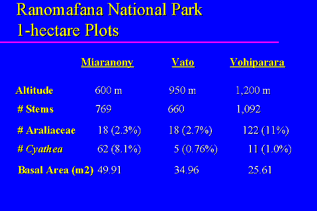
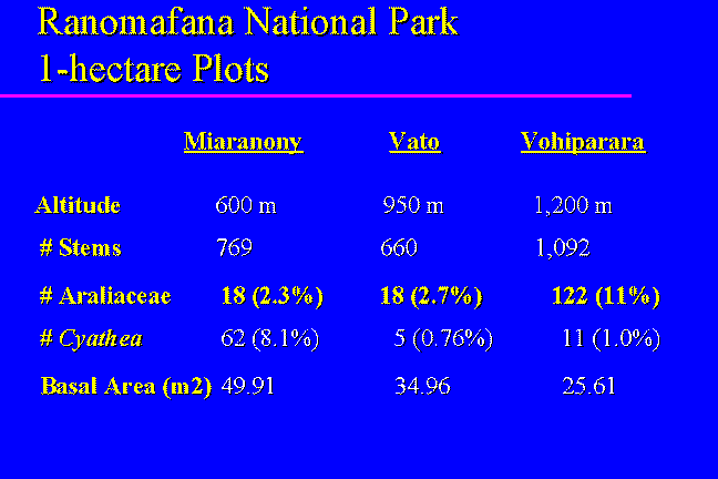
Data from three plots established at different altitudes at Ranomafana National Park show that forests as low down as 600 m at Miaranony have essentially the same floristic composition as those at Vatoharanana situated at 950 m. Several important observations can be made from the data.
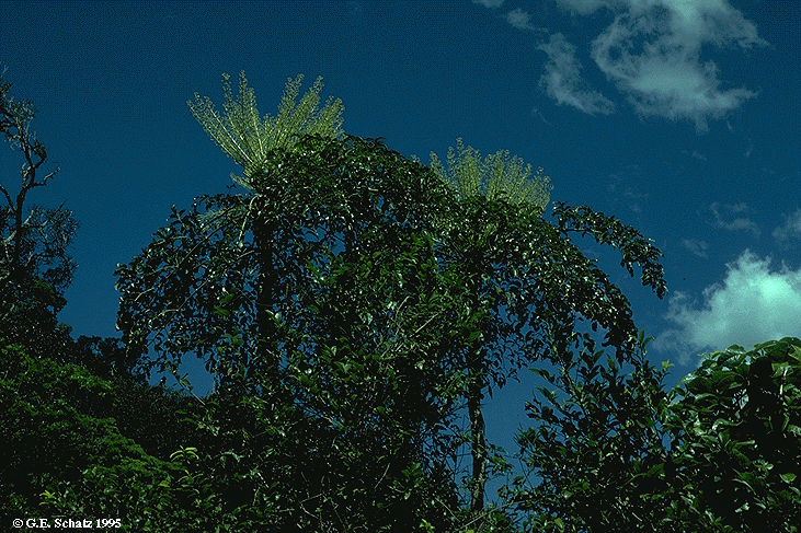
 Sloanea rhodantha
Sloanea rhodantha (Elaeocarpaceae) is one of the best indicators of mid-elevation forests, and its range at Ranomafana and elsewhere, along with those of several other taxa, extends below the classical 800 m line.
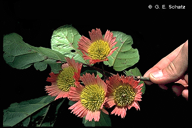
 Polyscias amplifolia
Similarly, species of Araliaceae such as Polyscias amplifolia are a dominant component of the vegetation at Vohiparara located at 1200 m, where they constitute 11% of the trees, and where the vegetation is substantially different from that occurring at 600 m and 950 m.
This and many other indications suggest that a much more thorough chorological study supported by an expanded network of 1-hectare plots, could greatly improve our understanding of altitudinal zonation in Madagascar's native vegetation.
The process of assembling the raw data for a thorough chorological study has already begun within the framework of the Madagascar Conspectus project. Data for about 65,000 specimen records have been captured to date, including large parts of the two principal herbaria in Madagascar (TAN and TEF), and verified records for over 26,000 botanical names have also been entered.
In order to perform the type of chorological analysis that is needed, however, botanical inventory work must also be expanded throughout large parts of the country, many of which remain very poorly explored. Carefully collected, geo-referenced plant specimens that have been accurately identified provide the only type of reliable data for use in such a chorological study.