The classification of vegetation has been an important theme of research in botany, ecology, geography, and other disciplines throughout much of this century. In Madagascar, vegetation classification began with Baron (1889), who recognized 3 regions, based exclusively on floristic criteria, i.e., the distribution of ca. 3,000 species whose ranges were reasonably well known at that time. Baron's approach was based on chorology -- the study of the geographic distribution of organisms (Turrill, 1958; White, 1993).
Over the next 75 years botanists refined their understanding of the Malagasy flora and vegetation. Starting with Viguier (1914) , but especially Perrier de la Bâthie (1921)
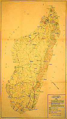
and later Humbert (1927, 1951, 1955) vegetation classification and mapping became increasingly sophisticated, culminating in the publication of Humbert and Cours Darne's (1965) map for the "Carte Internationale du Tapis Végétale et des Conditions Ecologiques" (Humbert and Cours Darne, 1965). Earlier maps had showed estimates of the native vegetation that was thought to occur before the arrival of humans on Madagascar; the 1965 map attempted to depict the coverage of both natural and anthropogenic vegetation as it existed in the late 1950s, based on information from aerial photographs and detailed topographic maps.
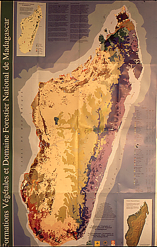
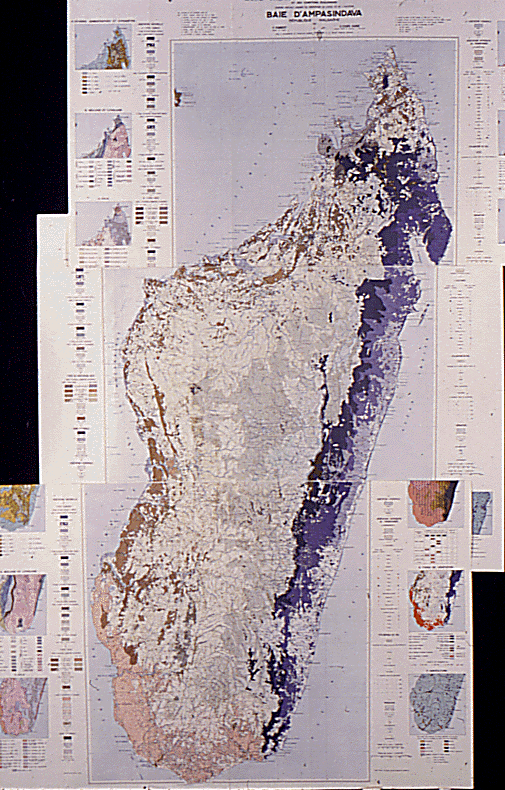
Faramalala (1988, 1995; Faramalala and Conservation International, 1995) has refined the map further using modern GIS technology, updating it with the interpretation of LANDSAT satellite images from the 1970s, although she has continued to follow Humbert's basic approach. Du Puy and Moat (in press ) have developed a simplified geology map of Madagascar, and have used it to reanalyze the relationships between broad rock type categories and existing primary vegetation as indicated on Faramalala's map. Their work shows the presence of unique vegetation types associated with specific substrates, many of which are currently unrepresented in the country's protected areas system.
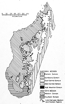
All of these classifications are based on a fundamental division of the country into two distinct floristic and vegetational regions that had first been proposed by Perrier de la Bâthie (1921).
-- The Flore au vent (windward flora), later re-named the Région de l'Est (Eastern Region), was considered to include the areas that come under the direct influence of the moist southeast trade winds, which produce moderate to very high levels of orographic precipitation as they encounter the mountains along the N-S axis of the island. The Eastern region also included western extensions into moist areas in the Sambirano, Isalo, and elsewhere.
-- The Flore sous le vent (leeward flora), now referred to as the Région de l'Ouest (Western Region), and which also includes the far North of the island, comes under the influence of the drying effects of the trade winds as they undergo adiabatic warming as they descend after crossing over the central plateau.